— LIVING WITH WILDFIRE IN AND AROUND THE MENDOCINO NATIONAL FOREST —
An all-hands, all-lands approach.
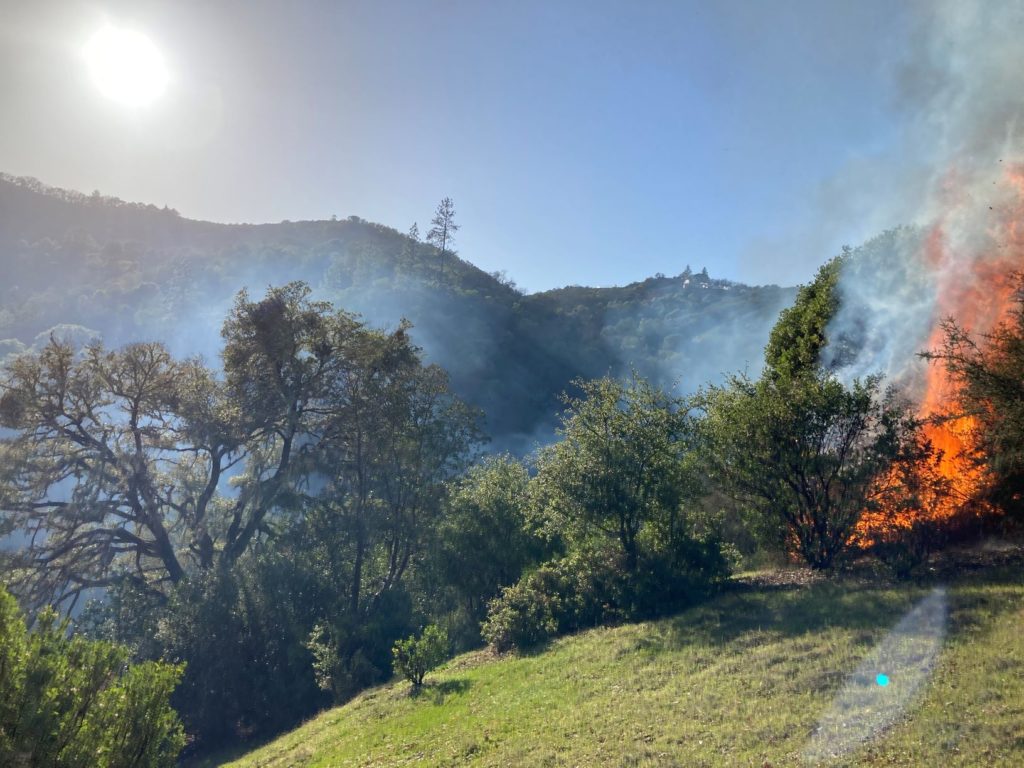
What is our fire future?
What do we want it to be?
|
||||||
|

FireScape Mendocino Projects and PODs
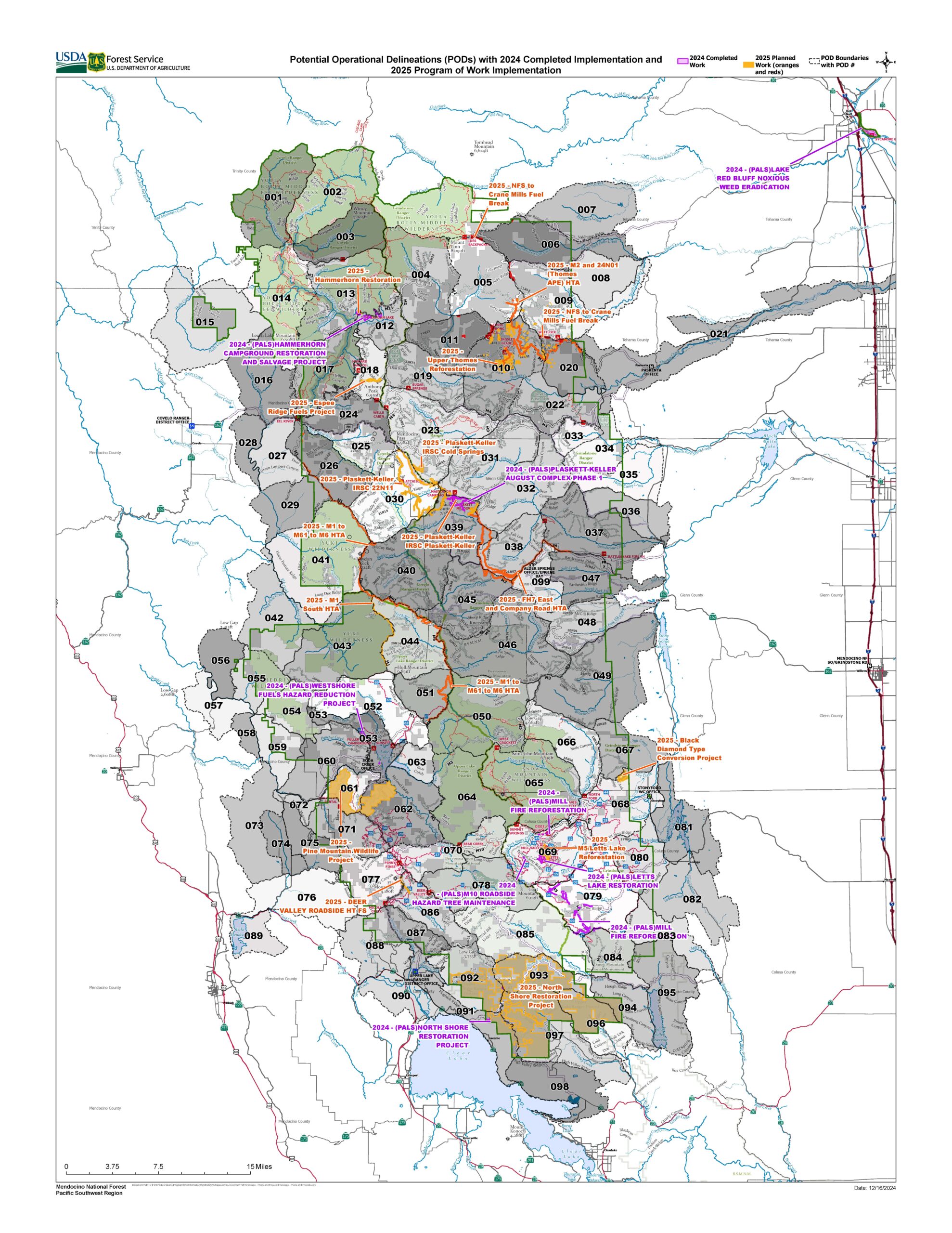
The map above shows current and past projects of the FireScape Mendocino stakeholder collaborate, overlaid with Mendocino National Forest’s Potential Operational Delineations (PODs). For a closer look, click on the map. For more information on PODs, see story below.
FireScape Mendocino Explores Potential wildfire Operational Delineations (PODs)
Managing Forests and Fire with PODs
By Bob Schneider, December 10, 2021
On December 7, 2021, Upper Lake District Manager Frank Aebly, Fuels Specialist Hinda Darner, retired Covelo Battalion leader Terry Warlick, and FireScape Mendocino Core Team Co-lead Bob Schneider attended the Mendocino and Sonoma Counties PODs workshop sponsored by the North Coast Resource Partnership (https://northcoastresourcepartnership.org). The following summary provides a focus for discussions by the FireScape Mendocino Core Team and other interested persons.
Potential wildfire Operational Delineations (PODs) are a tool created by Forest Service research scientists within the Rocky Mountains Research Station that may be useful for planning how to manage our forests, particularly for fuel reduction treatments and wildfires. When implemented, PODs can mitigate the risk from wildfire to important resources and ecological services, and address the use of wildfire as an ecological tool. While originally developed to assist fire and fuels managers in responding to the many large fires we are now seeing in federal wildlands, they also have a potential for assisting with forest resource management and protecting High Value Resource Assets (HVRAs).
PODs can be thought of as fire management and planning units with boundaries that are defined by potential control features (e.g., roads, ridgetops, water bodies, and other natural barriers), within which fire risks to resources and values can be quantified and summarized. When properly planned and implemented, PODs are a method to preplan for responding to fires that is defensible and transparent to the public. PODs combine expert knowledge with advanced fire modeling and spatial analysis to identify potential locations where fire suppression is likely to be effective, regardless of ownership boundary (Harden, 2020).
Designating PODs
There are a few basic steps used in developing PODs for a forest or region. This process utilizes Geographical Information Systems (GIS) to help identify, organize and interrelate information. But, much of this information can also be identified through the engagement of the general public who have personal knowledge of the forest. In addition, public engagement is a critical element in the development and use of PODs strategies from start to completion, and for ongoing updates.
- Highly Valued Resources and Assets (HVRA): In the forest this might include assets such as clusters of cabins, areas with large trees, rivers and lakes, habitat areas for rare and endangered species, inholdings, stands with timber values, Wilderness, Wild Rivers and Research Natural Areas, campgrounds, roads, bridges, and other infrastructure. A critical question is how value is assigned to each asset.
- Quantitative Wildfire Risk Assessment (QRA): The wildfire risk “triangle” includes probability of fire, fire intensity, and susceptibility to fire of all HVRAs. Fire simulation computer models generate and rank the positive or negative fire impacts in six fire-intensity categories.
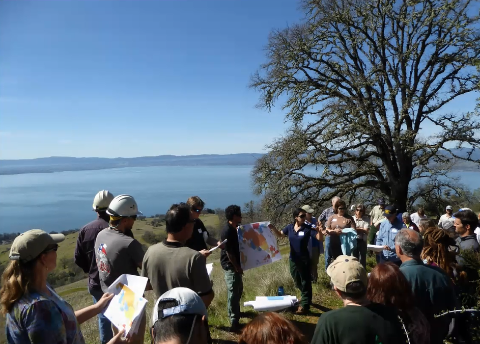
- Public Engagement: This is a critically important step in the delineations of PODs from the beginning to the end of the process. What are the highest public values in various parts of the forest? How susceptible is each value to various fire scenarios? What “defensive lines” and fire-management practices might work best to protect important valued resources and assets? Answering these questions can be accomplished through a series of public meetings. The public land agency (FS or BLM in our area) can provide the needed background mapping for public use, but the public must be engaged in defining values and developing planned responses within each POD unit.
- Delineating and updating PODS: PODs are polygons or shapes drawn on the landscape. POD boundaries may be ridge tops, roads, water bodies, or other natural or human-created barriers. The boundaries define locations that the management agencies use to initial responses to fires within each POD unit. They may be drawn around a watershed or sub-watershed, along ridges, or around a campground or group of inholder cabins. The objective of the delineation is to identify a unit within which the management response to wildfire is identified and agreed upon by people with responsibilities to manage fire in the unit. Critical factors to consider might be the appropriate treatment for a POD boundary such as sheltered fuel breaks or bulldozed fireline, a burnout along a road, or how much will it cost to maintain the fireline over time. The general public, user groups, stakeholders, tribes, and other interested persons are intended to participate in this part of POD development, utilizing digital technology or even paper maps and colored pens.
Takeaways:
- “Potential Operational Delineations (PODs) can be created collaboratively and are applications of strategic wildfire risk planning. PODs combine expert knowledge with advanced fire modeling and spatial analysis to identify potential locations where fire suppression is likely to be effective, regardless of ownership boundary.”[1]
- PODs were primarily developed in response to large wildland fires like what we are now facing They can assist firefighters in deciding where and how to fight a fire, or when to let it burn. PODs provide more manageable units that are integrated into the overall landscape across various political and agency boundaries.
- PODs can assist in designing and prioritizing forest restoration work. This is a key matter in growing the forests of the future that we want.
- PODs, properly designed with public engagement, can greatly enhance agency transparency.
FireScape Mendocino can and should play a key role in enabling and ensuring strong public engagement in PODs development and implementation.
[1] Harden, Gabrielle R. Fighting Wildfire with PODs (Potential Operational Delineations). March 9, 2020. https://forestry.usu.edu/news/utah-forest-newsletter/PODs_NM
Post-Ranch Fire Rehab Snow Mountain Wilderness Trails Project
With funding from the Great American Outdoors Act and the assistance of a Student Conservation Association trail crew, the Mendocino National Forest completed the Post-Ranch Fire Rehab Snow Mountain Wilderness Trail project in December 2021. The project included over 17 miles of heavy trail maintenance in the Snow Mountain Wilderness Area, restoring and improving public access, completing deferred maintenance, and reducing postfire erosion in the Little Stony and Eel River Watersheds.
To learn more about this project, find it on the Great American Outdoors Act StoryMap:
Our Shared Values
FireScape Mendocino believes that shared values of affected communities are important to identify, as they provide the foundation for project planning and implementation. Based on broad community input, we have identified the following shared values:
- Fire-adapted human communities
- A Fire-adapted landscape mosaic
- Cultural heritage that incorporates the past, present, and future
- Economic opportunities
- Outdoor recreation opportunities
- Long-term maintenance of terrestrial environments, particularly oak woodlands, meadows, late-seral conifer forests, and chaparral
- Long-term maintenance of aquatic and riparian environments
Our Strategies
Listed below are strategies FireScape Mendocino has developed through the collaborative process to improve the viability of our shared values.
- Build capacity of communities to increase defensible space; utilize Fire Safe Councils and Resource Conservation Districts where appropriate
- Implement collaborative vegetation management treatments
- Increase tribal involvement in land management
- Capitalize on climate change and wildfire emissions trade-offs to support air quality permitting for controlled burning
- Use fire education and outreach to support FireScape Mendocino projects and strategies
- Continue to build partnerships capable of addressing complex challenges in the landscape
- Configure management treatments to meet site-specific needs
Our Background
FireScape Mendocino is part of a national grassroots effort to enable people with diverse perspectives find agreement on forest health, watershed and fire planning. In 2013, with assistance from the Fire Learning Network and guided by the Open Standards for the Practice of Conservation, participants began to craft the vision and scope of the collaborative, and to identify strategies that address threats to their shared values.
Our Goals
- Increase communications between communities and organizations
- Strengthen relationship to value differences and leverage our strengths
- Help landowners and land managers address resource concerns on their property for the good of the community
- Grow each other’s capacity to be successful
- Implement forest health projects
Our Partners
FireScape Mendocino is part of the Fire Learning Network and is supported by Promoting Ecosystem Resilience and Fire Adapted Communities Together, a cooperative agreement between The Nature Conservancy, USDA Forest Service and agencies of the Department of the Interior and the US Fish and Wildlife Service. The partnership helps to restore our nation’s forests and grasslands and make communities safer from fire. This institution is an equal opportunity provider.